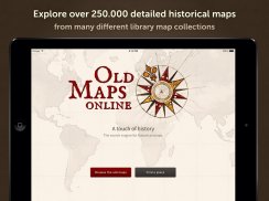
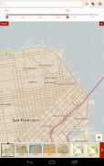
Old Maps is an application that offers users access to over 250,000 high-resolution historical maps spanning from the 15th to the 20th century. This app allows for a detailed exploration of ancient cartography from around the globe. Users can download Old Maps on the Android platform to experience a unique journey through historical locations.
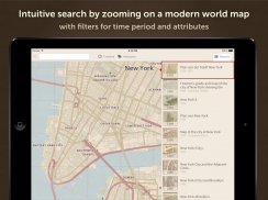
The application provides a variety of features designed to enhance user interaction with historical maps. Users can search for any location worldwide by entering its name, which facilitates quick access to relevant maps. Alternatively, the app allows users to zoom and pan across the maps themselves, offering an intuitive way to discover different regions and their historical representations. This capability ensures that users can find maps that are pertinent to their current location or areas of interest.
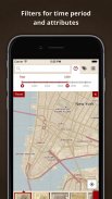
Old Maps incorporates a filtering system that enables users to narrow their search according to specific parameters. Filters can be applied based on the year, scale, title, or author of the maps, allowing for a tailored browsing experience. This ensures that users can find exactly what they are looking for without sifting through unrelated content. The ability to set filters enhances the overall efficiency of the map exploration process.
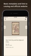
The app's user interface is designed to be straightforward, making it accessible to a wide audience. Users can easily scroll through a bar of search results, which makes navigating through the extensive collection of maps manageable. Each map is location-based, meaning that relevant historical maps can be displayed based on the user's geographic position. This feature is particularly useful for those wishing to explore the historical context of their surroundings, whether they are in major cities like New York, London, or Tokyo.
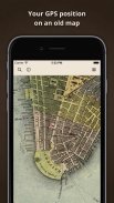
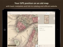
In addition to its search and filtering capabilities, Old Maps allows users to view their current GPS position directly on vintage maps. This feature combines modern technology with historical exploration, giving users a tangible connection to the past as they see their present location on centuries-old cartography. This interactive element fosters a deeper appreciation of historical geography and how landscapes have changed over time.
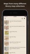
The app's collection includes maps from significant archives and libraries, such as the British Library and the National Library of Scotland. This affiliation with reputable institutions underscores the quality and authenticity of the maps available within the app. Users can trust that the maps they are accessing are sourced from respected collections, which adds to the educational value of the application.
Old Maps caters to a diverse audience, including history enthusiasts, educators, students, and casual users interested in exploring the past. The application serves as an educational tool that can enhance learning experiences by providing visual context to historical events and geographical changes. Users can engage with history in a way that is both informative and visually stimulating.
The app also allows users to save maps for offline viewing, which can be particularly beneficial for those who may not have consistent internet access. This feature ensures that users can continue to explore historical maps at their convenience, regardless of their connectivity. The offline access adds another layer of flexibility to how users interact with the app.
Old Maps is consistently updated with new content, ensuring that the collection remains relevant and expansive. This commitment to adding new maps allows users to continually discover new historical treasures and engage with different regions and time periods. The dynamic nature of the app keeps users returning for fresh content and new explorations.
The app's straightforward design and rich features make it an excellent tool for anyone interested in history and geography. By providing easy access to a wealth of historical maps, Old Maps fosters an appreciation for the past while also utilizing modern technology to enhance the user experience. Users can delve into the stories behind the maps and gain insights into how historical events have shaped the world we live in today.
With its extensive collection, user-friendly features, and educational potential, Old Maps stands out as a valuable resource for exploring historical cartography. The blend of old and new, combined with the ability to see one's location on historical maps, makes this app a unique offering in the realm of digital exploration. For those eager to explore historical geography, downloading Old Maps opens a portal to the past, allowing for a deeper understanding of the world’s historical landscapes.
For more information, visit the website www.oldmapsonline.org.